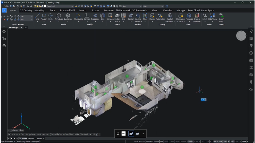
With 3D laser-scanning technology increasingly used in the Surveying and AEC sectors, we look at how CAD users can get the most from their tools in workflows for design and construction site data.
At Bricsys, our intelligent tools and advanced features for 3D laser-scanning workflows help create the deliverables required by your clients.
To highlight the tools and features you can use, here we review how CAD users can work with imported data for Scan-to-Plan workflows.
BricsCAD BIM has native point-cloud functionality that lets you quickly go from a scan to a plan using intelligent, automated tools.
You can use the Section Tool to create a section plane along the area of the point-cloud you're working on. Just drag it up and down to get the best fit.
You can also turn this into a volume section, and use this as the selection item for the point-cloud Project Section command. The Project Section command allows you to create 2D projections of a point-cloud using section volumes. You can set tolerances for resolution and pixel size, and wall detection settings such as gap tolerances or minimum length and alignment angle.
Once you’ve completed this, BricsCAD BIM creates a projection with polylines that have been detected. And with the projection created, you can use BricsCAD's intelligent AI-driven tools to further refine your plan.
Use the unique Optimize command for 2D entities and 3D entities
The Optimize command lets you rectify the wall lines by setting tolerances for angles, gap distances, and whether to close those gaps, amongst other options. These tolerances can be changed in the panel, and you can preview this before you commit – you don't have to go back and rerun the command or undo something which wasn’t wanted.
Additionally, the Optimize command works on 2D entities and 3D entities, so you could also use this tool when creating room solids.
Continue drafting your Scan-to-Plan with AI-driven tools
From this point, you can use regular CAD drafting tools to complete the final mile: join, offset, stretch, trim or delete. This will give you a plan with polylines representing the walls within your building. From there, add wall and room dimensions and use AI-driven tools, such as Copy Guided, to quickly and easily add elements such as windows to the floor plan.
Deliver a Scan-to-Plan to your customer
Then create a deliverable, either as a printed document or PDF file.
With BricsCAD BIM, you can work with point-clouds in multiple formats, and you have the tools to create accurate 2D plans in simple steps.
Discover the BricsCAD difference
With BricsCAD, surveyors can reduce costs and drive project efficiency. Our CAD-based platform comes with intelligent commands and tools to accelerate your point-cloud workflow, while our partner apps provide advance survey features.
Discover the BricsCAD difference, and find out more about our Land Surveyor solutions.
To review more tools and features in CAD for your industries and roles, you can explore how to build better workflows with BricsCAD’s interoperable, intuitive and open solutions. We can’t wait for you to join and connect with the Bricsys community.

