If you work in the CAD/BIM industry, you've likely heard of GIS, but what is it exactly?
What does GIS stand for?
G.I.S. stands for:
Geographic Information System
What is GIS?
GIS or Geographic Information Systems largely refers to any thing that measures, records, analyzes, and manipulates geographical and spatial information. This can include hardware, software, the data itself and even any trained personnel that work in the field.
Think maps, but on a far more detailed and complex level. GIS can be used to analyze information such as topography, geographical location, infrastructures such as drainage or transport systems, mobile signal strength, etc. It's a very complex and diverse field, that we only have time to cover very briefly in this blog. But there are some great resources online.

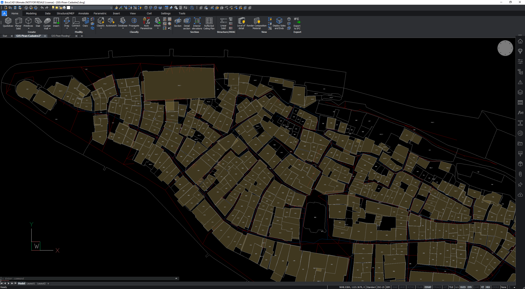
Example of how GIS can be used to analyze flooding. First, publicly available GIS data was imported and arranged in QGIS, then exported into DXF or raster and imported into BricsCAD.
What is GIS used for?
GIS is a way to collect, manage and analyze geographical data and it integrates many types of data. You can use it to analyze spatial locations and create visualizations, such as maps and 3D scenes.
GIS allows people to sort data to better aid visualization of the data. Doing this helps identify patterns, relationships, and situations, helping users make more informed decisions.
Who uses GIS?
Almost everyone uses GIS. Even you! If you've used Google Maps, then you've used GIS!
Thousands of organizations in almost every field use GIS to make maps to communicate, perform analysis, share information, and solve problems. Industries as wide-ranging as education, construction, infrastructure, project management, insurance, manufacturing, emergency services, conservation, real estate, retail, telecommunications, transportation, utilities, natural resources, government and more, all use GIS.
Even dentists have been known to use GIS technology to locate tooth cavities.
Is GIS data Vector or Raster?
GIS can be both vector and raster. Vector data will be familiar to CAD users. Vector data is mathematical, making it infinitely scalable and is represented as points, lines, surfaces, etc.
Raster data has a finite size or resolution, it can take the form of images, such as satellite photography.

Example of GIS in use. First, publicly available GIS data was imported and arranged in QGIS, then exported into DXF or raster and imported into BricsCAD.
Is GIS the same as Geospatial?
GIS and geospatial are not the same thing. Many people confuse GIS and geospatial, but there are differences!
GIS refers to the whole system of geographical measurement and analysis.
Geospatial typical refers only to the data and the technology. It's a relatively new word that has only been in use since the 80s.
What is Geospatial Data?
Geospatial data is any data that contains geographical information within it. From latitudinal, longitudinal & elevation coordinates, to zip codes.
What is Geospatial Technology?
Geospatial technology is any technology that is used to collect, analyze and store geospatial data. Yes, even BricsCAD can technically be considered 'geospatial technology'!
Did you know?
There is an International GIS Day?
More Back to Basics:
- What is CAD?
- What is DWG?
- What is BIM?
- What is CAD/CAM?
- What is GIS?
- Vector vs Raster

