BricsCAD® Pro V24 brings a full suite of civil and survey tools for civil engineers and surveyors. We know that TIN surfaces are at the core of most civil and survey projects - so it is vital that these TIN surfaces are accurate and efficient to work with. With this release, you can look forward to a roundtrip GIS workflow, enhanced TIN surface user interface, creating TIN surfaces from contour data, new transparent commands, and more! Let's take a look at what BricsCAD Pro V24 has to offer for civil and survey users!
Create and Edit a TIN Surface in BricsCAD® Pro V24
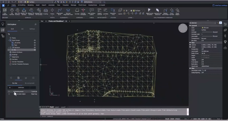
Our latest release of BricsCAD Pro has made working with TIN surfaces easier than ever, and the improved UI makes it more intuitive and easy to learn. You can create a TIN surface quickly by selecting a group of survey points while maintaining the visibility of how that TIN was created. You can also easily edit parameters like the edge length to ensure your TIN surface is as accurate as possible.
New Transparent Commands in BricsCAD® Pro V24
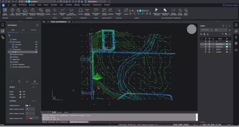
Use the new transparent commands to enter data in common Civil/Survey formats. You can use this to enter break line data, for example, specifying civil point numbers or snapping to any part of a point object. Once you have created your break lines, adding this data is simple and fast - immediately updating the surface and also allowing you to update any civil points that may be incorrect via the Properties Panel.
Create a TIN surface from Contour Data with BricsCAD® Pro V24
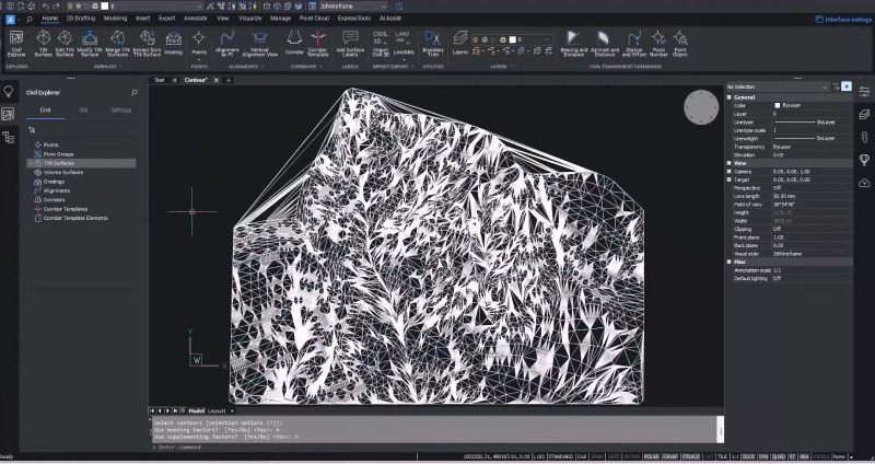
We know from our user feedback that sometimes you can only access contour data to create your TIN surface. In BricsCAD Pro V24, we added the ability to create a TIN surface directly from contours rather than treating the contours as break lines. Now, you can minimize flat areas usually created by contour data - significantly increasing the accuracy of your TIN surface! You can add supplemental vertices to ensure that curves are maintained or weed out vertices from over-digitized data, and you also have the option to remove the outer edges. Contour data may not be the ideal start to creating a TIN surface, but with BricsCAD Pro V24, it is now possible to use it and create a better, more accurate, and more efficient TIN surface.
New to V24: GIS Workflow in BricsCAD® Pro
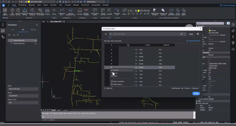
Our user feedback and requests led us to build on the GIS import function, and it is now possible to roundtrip GIS data. With BricsCAD V24, you can read object data from AutoCAD® Map or Civil 3D® files and import that data into an attribute table. You can select attributes and records in the table, then zoom to items or the table line for an item. The filter option in the GIS Attribute Table lets you filter items based on attribute data so you can quickly find the objects you need. You can also add to your filters to further refine your search.
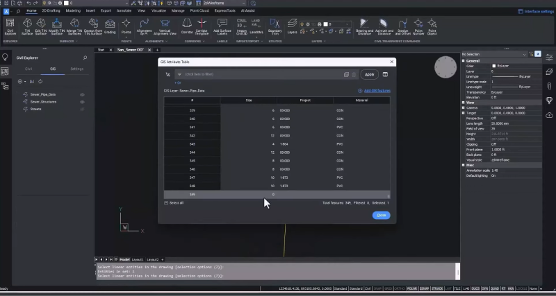
For BricsCAD V24, we've enhanced the import GIS data function, so now you can create and edit objects using the CAD commands you already know and the new transparent commands, which enable you to enter data in common civil and survey formats, including bearing and distance. From there, you can add GIS attribute data directly into the existing table.
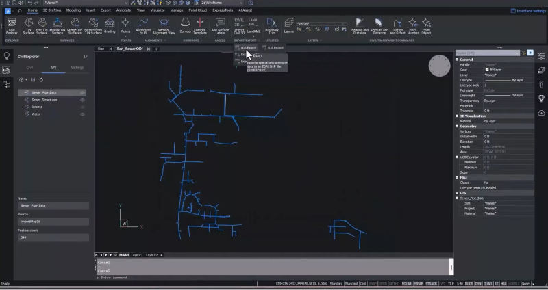
The new functionalities in BricsCAD V24 mean you can use GIS data workflows within a single CAD environment. You can now create GIS layers from scratch by specifying the name, geometry type, and attribute data. Then, draw objects using familiar CAD commands and add them to the GIS layer with any attribute data. Easily share your data with stakeholders by selecting what you want to share and exporting it to a shapefile.
Since BricsCAD V19, we have introduced practical tools for civil engineers and surveyors to boost their productivity, focusing on creating accurate and efficient TIN surfaces and grading objects faster. In BricsCAD Pro V24, we've honed in on these areas to bring you a full suite of powerful civil and survey tools that are easy to use and accelerate your workflow.
There's plenty more in BricsCAD V24 for civil and survey users, so watch our Breakout Sessions for an in-depth look at some of these new features!
Get started with BricsCAD® V24 today!
Buy BricsCAD or download the 30-day free trial now and discover how you can accelerate your time to deliverable with BricsCAD.
Have you used BricsCAD® V24 and have some ideas or suggestions?
Fantastic! We love hearing your thoughts on BricsCAD® – all feedback is welcome, whether good or bad. The best way to tell us what you think about BricsCAD is to send us a support request; our support team will gladly help.
Want to learn more about BricsCAD® V24?
If you're curious about what else you can do in BricsCAD V24, check out our YouTube channel or take a peek at the rest of the Bricsys blog to learn more!

